Before I left home for the weekend I plotted my route for the entire trip, including the return leg. I didn't know what kind of mood I would be in after two full days of high-concentration driving, and whether I'd still want to explore, or just make a beeline home. The nice thing about both of my maps is that they offered multiple options to break away from the twisties and jump on a highway for a more direct route if my mood changed.
So I set an ambitious course for Monday to give myself the option. Even as I loaded up my bags to leave Palm Springs I didn't know how much I'd stick to the itinerary. In the end, I did it all. Here's the route:

Google map link: https://goo.gl/maps/FzsCY1EHcU47Tez2A
- I-10 out of Palm Springs to I-215 north out of San Bernardino
- West at the Cajon Junction to Long Pine Canyon Road into Wrightwood
- Big Pines Highway northwest through Valyermo, back roads to bypass Palmdale
- Elizabeth Lake Road northwest through Andrade Corner as it becomes Pine Canyon Road
- Left to stay on Pine Canyon Road, right on Old Ridge Route, into Gorman for fuel and food
- West on Frazier Mountain Park Road, continue as it becomes Hudson Ranch Road
- North on 33
- West on 58 to Atascadero, final fuel stop
- 101 north to the bay.

There was a "Chains Required" sign at the east end of Lone Pine Canyon Road, but with no white stuff in view I was dubious. I watched a dozen non-AWD sedans go by on what looked like normal tires, and decided to press on.

I saw my first patches of snow on Long Pine Canyon, little pockets up high in the hills on the side of the valley I was in, and then a little bit closer as I started gaining elevation. By the time I came into the back side of Wrightwood there was snow on the ground, but dirty enough to convince me that it had been cleared some time ago. One house on the left had a shiny C3 Corvette parked out front with the windows down, so I took this as a good omen.
By the time I reached the west side of Wrightwood, it was spitting rain and the Focus indicated 42F. There was a good amount of snow lining the road and a gravel mixture laid down some time ago by a road crew. I don't know if California uses salt... hope not. I had to stop for a photo in front of Mountain High ski hill.
I turned off of as CA-2 became the famous Angeles Crest Highway, picking up Big Pines Highway. I nearly lost my nerve at this point, as this road immediately had less traffic, more light rain, and substantial buildup of snow on the shoulders. After some tentative driving I started to go down hill and the snow lessened steadily.

It wasn't long at all before I was in a very different, very barren landscape. Unfortunately wild fire is an increasingly frequent occurrence all over the state, and this must have burned fairly recently, as there was almost no new growth at all.
Google street view shows that it looked quite different in 2017: https://goo.gl/maps/3CXvRz2cmttZTLus6


I pressed on, cutting west across the hillside and bypassing Palmdale to get to Elizabeth Lake Road. This was a relaxed drive in low hill country with some lakes and homes. At the Three Points junction I turned left to stay on what was now Pine Canyon Road. On this section of the road the center line disappeared and there was a heavy coating of gravel and sand. More than any other time on the trip, I was happy here that I was not in the Skyline, sandblasting the paint. The Focus has a clear bra and mud flaps that seem to have done a very respectable job dealing with the shrapnel. A good thing, because I certainly wasn't going to slow down for it.
Pine Canyon teed off into Ridge Route Road / Old Ridge Route, where I got these photos overlooking CA138 and Quail Lake. I used Gorman Point Road to continue avoiding I-5 and hit downtown Gorman for a fuel and lunch stop.

The cockpit. Yeah sure you could argue that EVs and autonomy are the biggest revolutions in the last decade of car tech... but you'd be wrong. It's Apple CarPlay, saving us all from terrible OEM infotainment systems. I've got Ford's CF shift knob, door 'spears,' gauge trim, and euro cup holder spicing up the interior. I must be getting old to say this, but the power lumbar support on the seats is excellent for these long road trips. It's not that one position is always more comfortable than the other, it's just that being able to vary the positions really helps with fatigue.

Dirt collecting in all pockets of turbulent air. I have to admit, with tire protection as my top priority, I was nervous pulling onto all of these dirt shoulders for photo ops.
After lunch and fuel in Gorman, I danced around I-5 and used Ralphs Ranch Road to get to Frazier Mountain Park Road, which I took westward. This road changes names a few times and routes through a few different cabin-y vacation towns: Frazier Park, Pinon Pines Estates, and Pine Mountain Club. I didn't see any particularly tall peaks, but it all had the feel of a ski town, just without snow. I'm not sure why you'd come to this area, which is not particularly convenient to... well... anything?
I was mixed in with local traffic for the first half of this stretch, and it was drizzling and wet. There were multiple warning signs along the way: chains required; some type of park pass required; bears. I ignored them all and hoped that I would not have to turn around and backtrack to I-5 (ew).
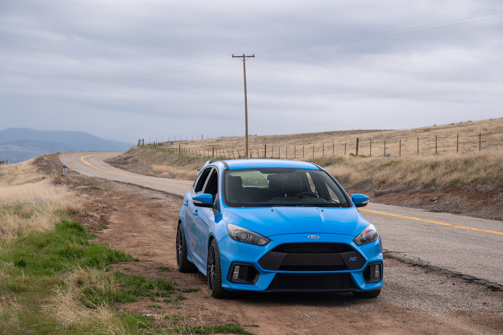
Once through Pine Mountain Club, I was suddenly on my own. The precipitation dried up, the road started curving, and it was pure driving enjoyment.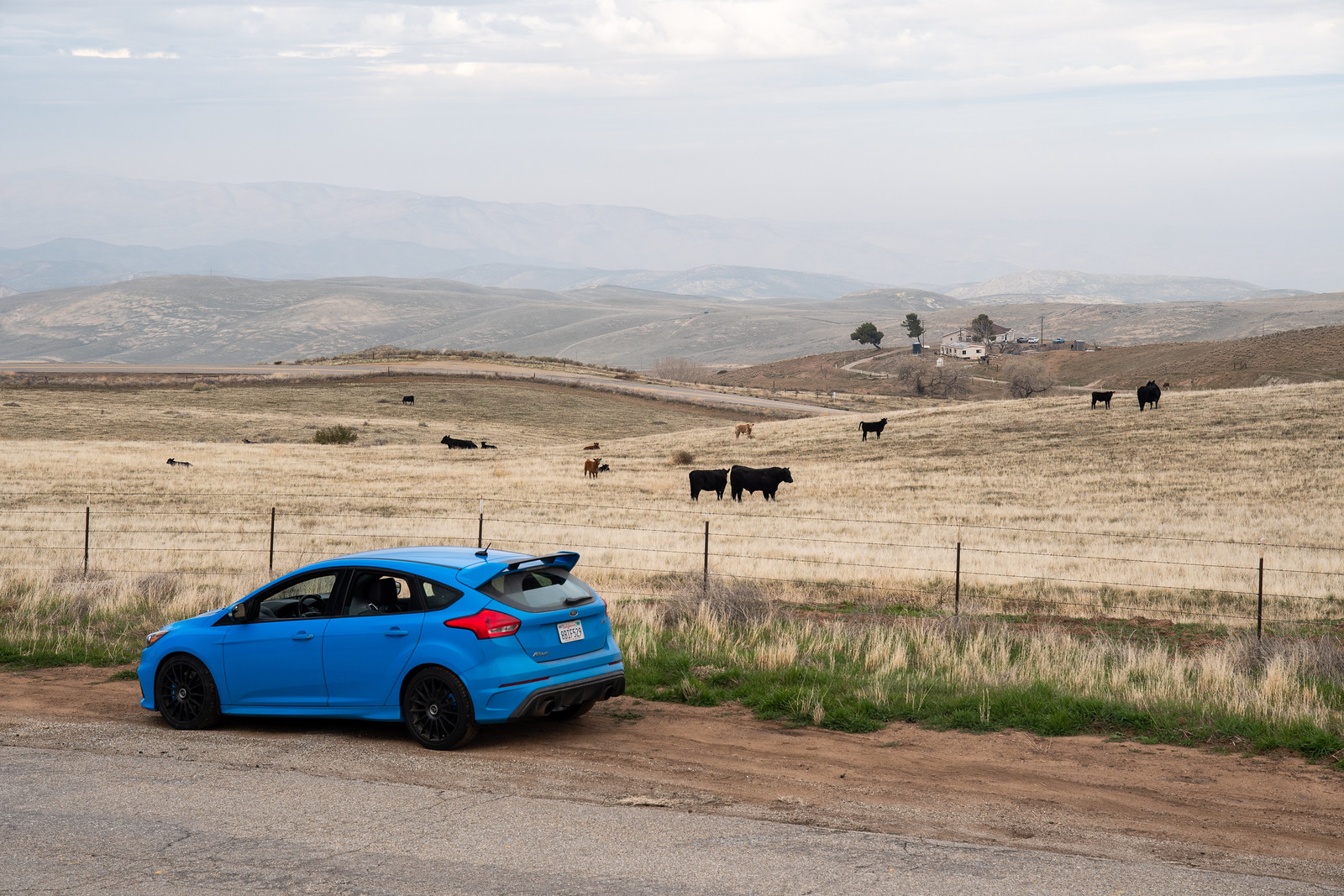
The best part came toward the end, once inside the Bitter Creek National Wildlife Refuge. I'm not sure if these cows are the main attraction of the refuge, but they were quite vocal, mooing belligerently as I snapped photos.

It was all rolling hills and muted tones of yellow, green, and grey, in some areas nothing but seas of grass with distant mountains forming a backdrop. Serenely quiet too - aside from the cows.
Hudson Ranch Road dumped me back into CA33, which I drove on my trip down. This time I turned right to head north, back through Maricopa and Taft. This whole area is an oil field and for long stretches there is nothing to see but oil derricks. 
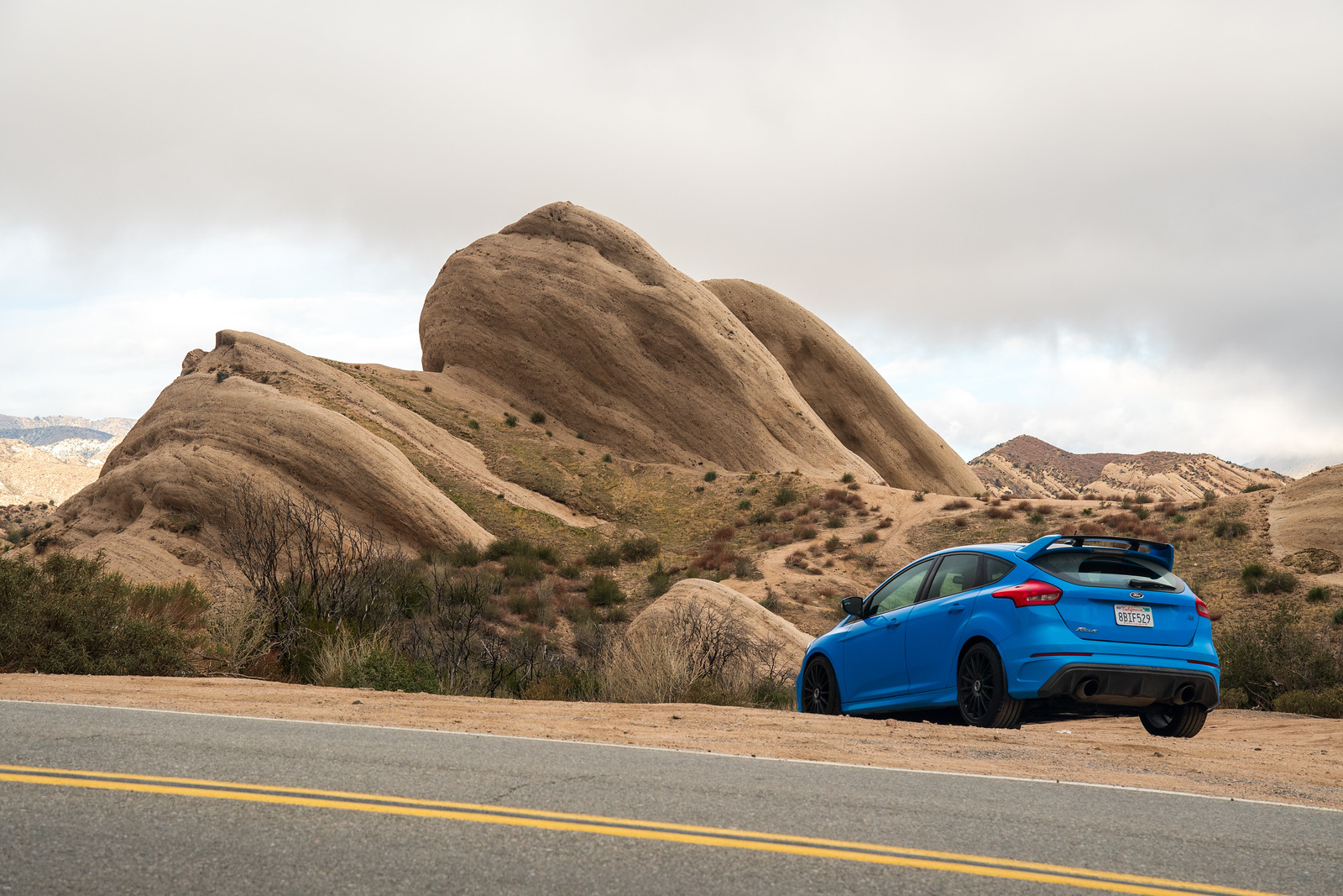
CA58 was so good the first time that I decided to take it back. This time there was no rain, and I had a cracking run at the technical climb on the east side. No traffic, just switchbacks. I also made an effort to take better photos, having done so poorly on the way down.
I think I said before that CA58 has a little bit of everything. The photo above shows the transition from the initial twisty bit to the flat, straight bit.

But the flatness is misleading, because the road goes up and over "whoops" that, with enough speed, float your bum out of your seat. You can sorta make them out above.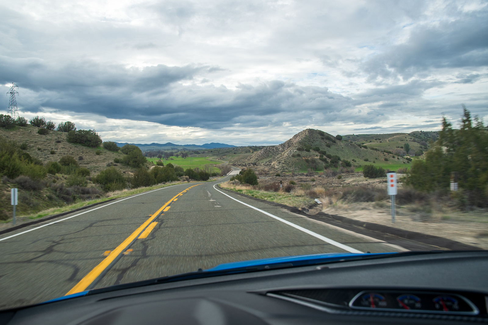
When you are through the flat straight bit, it flows and highway speeds are no problem. Lovely.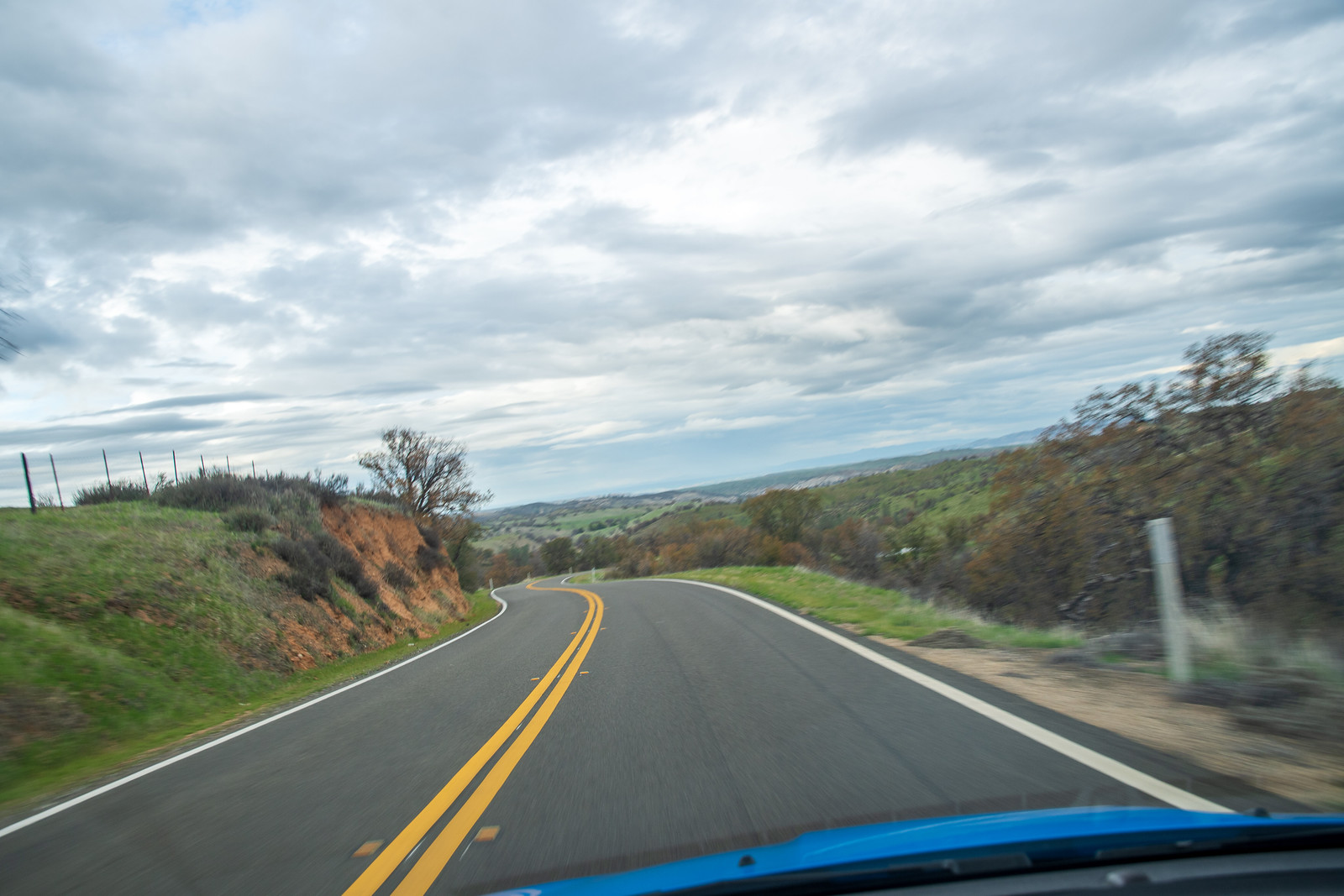

Eventually the ride had to end, and I connected onto 101 through the charming little town of Santa Margarita. One last fuel stop at Atascadero and it was cruise control and audiobook time.
I made it home without incident. The filthy focus, trunk full of tire repair sundries and spare oil, didn't need a bit of it. All in all: 1,121 miles and not a hiccup. Despite being in the driver's seat for 9+ hours I arrived home feeling refreshed, almost wanting to keep going to find the next new road. Almost. But all good things must come to an end, and it was back to work the next morning.
Thanks for reading, I know this was a long one. If you find yourself in a good car, needing to get from LA to SF or the other way around, I recommend any of the roads that I followed on this trip. And though I've said it before, I'll say it again... the RS is an incredible vehicle! A Swiss Army knife of capability. Daily, long-distance cruiser, fun on a backroad at reasonable speeds, fast around the track.
videol - youtube.com
ReplyDeleteVideos of the latest videol released by best youtube to mp3 converter app a gaming company. from an old, obscure arcade game, in a futuristic Sega Genesis gaming console. It was 2 posts · I have to say, there is never a dull moment when I was playing this video.